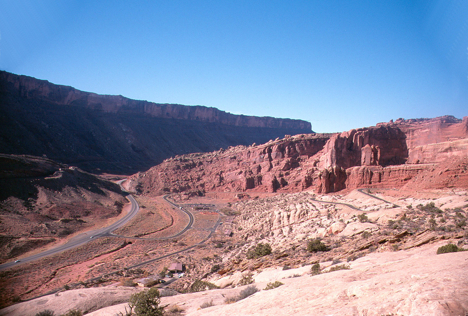
| Title | Looking north at the Moab Fault, entrance to Arches National Park |
|---|
| Description | The Moab Fault follows US 191 north of Moab, Utah. It runs along the base of the cliff in the upper left part of this picture. On the east side of the fault: the white rock in the foreground is Jurassic Navajo Sandstone. It is overlain by the red Entrada Sandstone, also Jurassic. On the west side of the fault, older rocks have been uplifted. The cliff is capped by Jurassic Wingate Sandstone. Slopes below are mostly the Triassic Chinle and Moenkopi Formations. Although hard to see, the entrance station for Arches National Park is in the center of the picture. |
|---|
| Chronostratigraphy | Jurassic, Triassic |
|---|
| Lithostratigraphy | Entrada Sandstone, Navajo Sandstone, Kayenta Formation, Wingate Sandstone, Chinle Formation, Moenkopi Formation |
|---|
| Location | USA ▹ Utah. Near Moab. Arches National Park. |
|---|
| Photographer | Dexter Perkins. 1999. |
|---|
| Collection | E361113991P. |
|---|
| Key words | Arches National Park, Entrada, Navajo, Wingate, Chinle, Moenkopi, sandstone |
|---|
| Tech details | 532 KB. Vista. Canon Eos Rebel, 55 mm lens, Fuji Provia 100. |
|---|
| GeoDIL number | 514 |
|---|
 |
