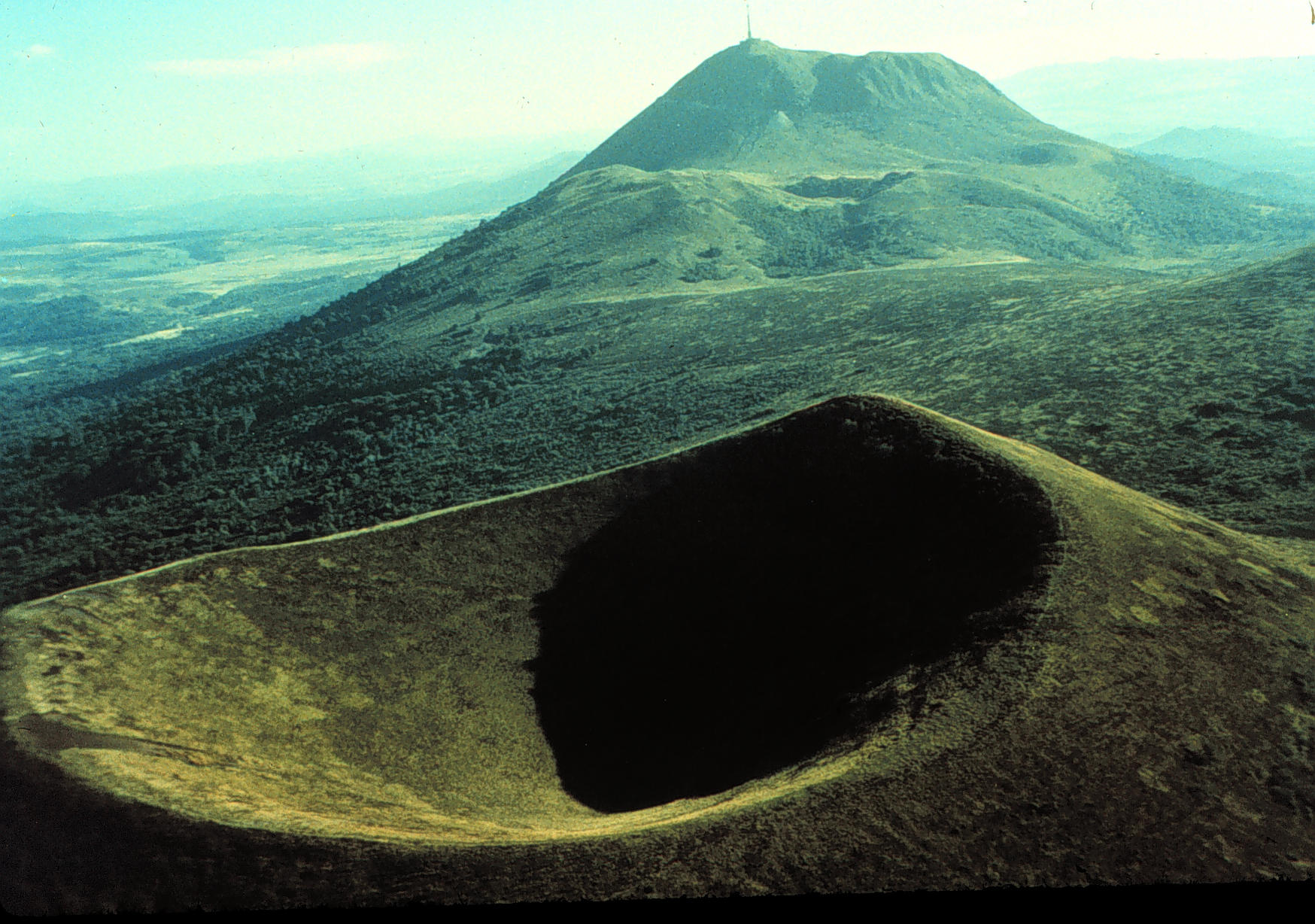
| Title | Puy de Pariou and Puy de Dome, Auvergne, France |
|---|
| Description | The Massif Central in the center of France (Auvergne region), contains a range of volcanoes made up of the Monts Dome (1465 meters at the Puy de Dome) and the Monts Dore (1886 meters at the Puy de Sancy). Eruptions included both Peleean (involving the formation and collapse of lava domes) and Strombolian (lava fountains and ejection of cinders, lapilli, blocks and bombs). The last eruptions were about 4,000 years ago. The region includes a variety of volcanic landforms today. Locally, steep sided volcanoes are called puy (“pwee”). Classic cinder cones with large summit craters, such as the Puy de Pariou (which erupted about 8,200 years ago) seen here, are common. The Puy de Dome (in background, erupted about 10,000 ago) is the highest of the most recent volcanic peaks (the Monts Dome). It formed from a series of lava domes. |
|---|
| Geologic province | Massif Central |
|---|
| Location | France ▹ Auvergne. Near Clermont-Ferrand. |
|---|
| Photographer | Dexter Perkins. 1990. |
|---|
| Key words | volcano, puy, Auvergne, Massif Central, cinder cones, dome |
|---|
| Tech details | 391 KB. Vista. Canon FTQL. |
|---|
| GeoDIL number | 2451 |
|---|
 |
