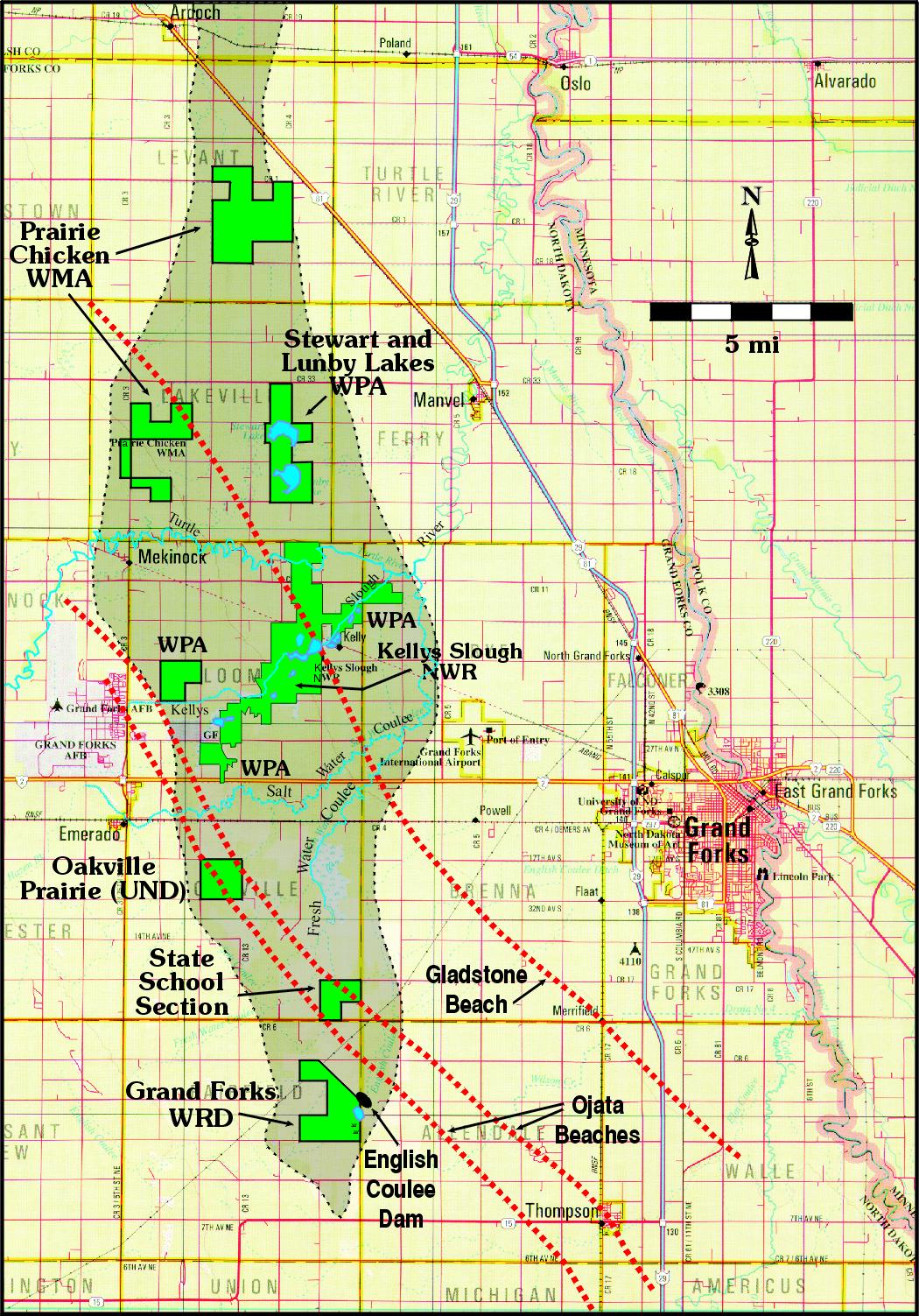
| Description | Land not otherwise labeled is under private ownership. Abbreviations and names for public lands include WMA - Waterfowl Management Area, WPA - Waterfowl Production Area, NWR - National Wildlife Refuge, WRD - Grand Forks County Water Resources District, UND - University of North Dakota, and State School Section land. The Ojata and Gladstone Beaches represent minor topographic features produced by Glacial Lake Agassiz as a result of the melting of the Wisconsinan continental glacier. The base map is from the North Dakota Atlas and Gazetteer (1999, p. 30). |
|---|
