A Geoscience Digital Image Library
A Geoscience Digital Image Library

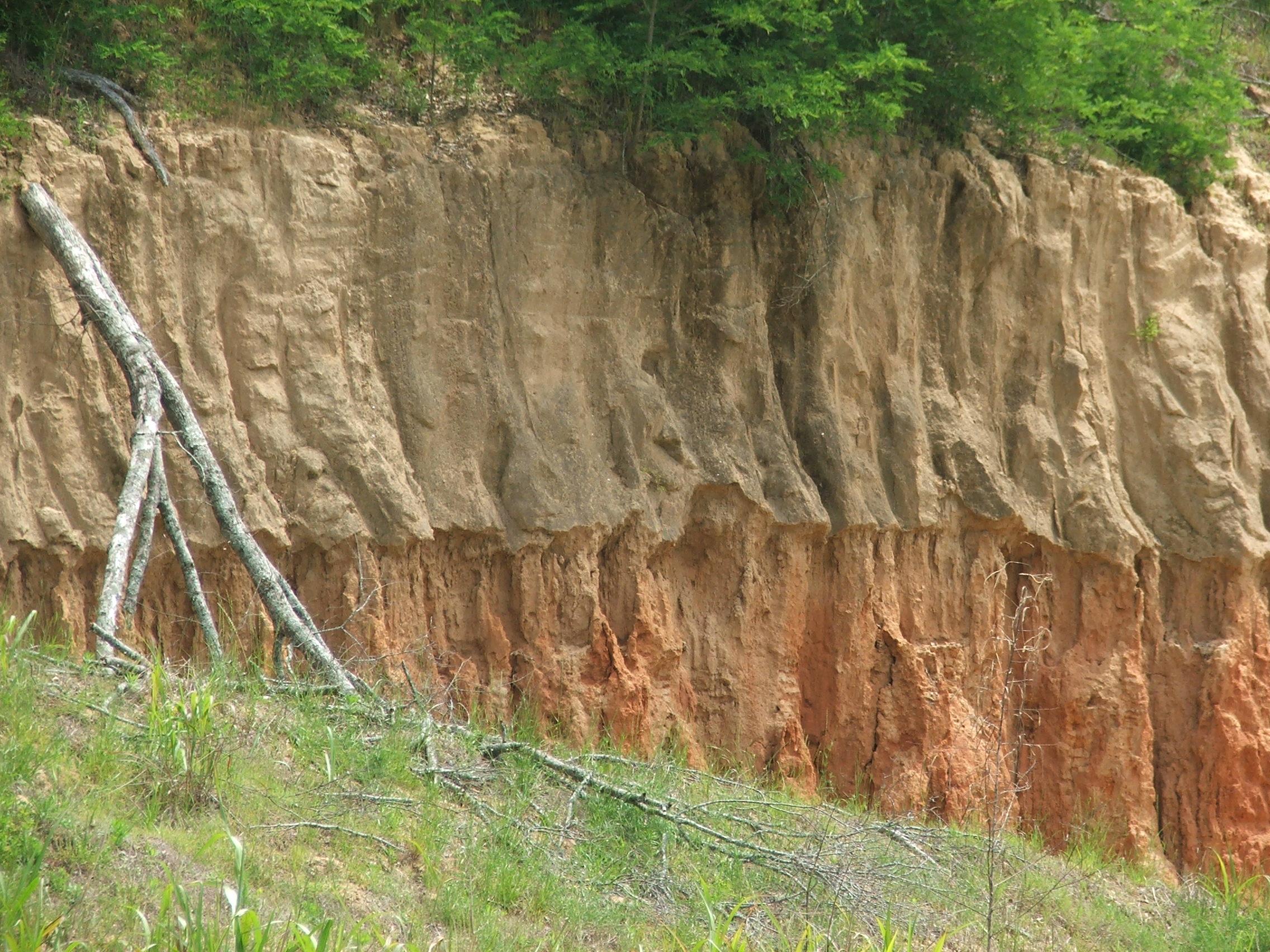
| Title | Loess outcrop near Port Gibson, MS |
|---|---|
| Description | This is a typical loess hill south of Vicksburg, MS. Note the vertical slope face. The top layer is approximately 4 feet thick. Both layers are wind blown silt. |
| Location | US ▹ Mississippi ▹ Jefferson. Near Port Gibson. |
| Coordinates | 31.830833,-90.959444 |
| Photographer | Lance Yarbrough. 2008-12-09. |
| Key words | loess, Mississippi, Vicksburg |
| Tech details | 731 KB. Outcrop. Fujifilm FinePix S9500. |
| GeoDIL number | 3137 |
| Copyright | Lance Yarbrough |